Balwyn is a suburb in the northerly part of the City of Boroondara in Melbourne. White views of the area which became Boroondara first occurred in 1803, when explorer Charles Grimes sailed up the Yarra River. He traversed part of Boroondara’s western boundary From Kooyongkoot (now Gardiner’s) Creek to Dight’s Falls.
Following the arrival of Batman and Fawkner, who settled and founded Melbourne in 1835, the next contact followed when John Gardiner in 1836 crossed to the south of the Yarra River to graze cattle. He settled in Boroondara for a time near the junction of Kooyongkoot (Gardiner’s) Creek and the Yarra, while other squatters also took licenses and grazed stock in the Boroondara area.
Governor Bourke formally founded Melbourne in 1837. He appointed Robert Hoddle as official surveyor. Hoddle laid out Melbourne’s central grid, and also many surrounding areas. In 1838 Hoddle mapped and surveyed the Parish of Boroondara, whose boundaries are very similar to the present City of Boroondara.
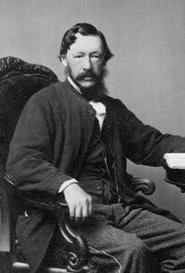
Balwyn’s settled history began in 1841, when Henry Elgar acquired a Special Survey of 5120 acres (8 square miles or 2072 hectares), mostly in the north of Boroondara but partly edging over into the adjoining Parish of Bulleen. Most of the Survey area we now know as Balwyn and Balwyn North. Elgar never lived in the Survey, he returned to Sydney and onsold it to associates, who then subdivided and sold it as farm and grazing allotments. Farm houses and properties were progressively established in the area in the late 1840s and the 1850s.
Pioneer settler and sometime Argus commercial editor Andrew Murray purchased one subdivision, planted a vineyard, and in about 1858 built a house he named Balwyn (reputedly after Celtic bal hill and Saxon wyn wine). The adjoining road was named Balwyn Road, and the district surrounding the intersection of Balwyn and Whitehorse Roads became known as Balwyn.
Initially Balwyn was simply the centre of a small farming community, comprising a blacksmiths plus a few shops. A public hall, known as the Athenaeum, was built in Balwyn Rd north of Whitehorse Rd later in the 1860s. Balwyn’s first Primary School opened in the hall in 1868, moving to its present site south of Whitehorse Rd in 1880. Anglican worship also commenced in the hall in 1868. Anglicans meanwhile built a church in Balwyn Rd next to the school site, and St Barnabas’ Church was consecrated in 1872. Finally in 1874 a Post Office was opened, also in Balwyn Rd.
As Balwyn developed, political evolution also continued in the wider Boroondara community. In 1854 the Boroondara Roads Board was created, to raise revenue to maintain roads in the Parish. Kew and Hawthorn, being closer to Melbourne with better transport access, developed faster than the outer area and sought separation from the Roads Board. In 1860 Hawthorn and Kew were removed from Boroondara to become new municipalities (ultimately becoming the Cities of Kew and Hawthorn). In 1871 the remaining Boroondara area became the Shire of Boroondara (and by stages the Borough, Town, and finally the City of Camberwell). History turned full circle over a century later, when in 1994 the Cities of Camberwell, Hawthorn and Kew were merged to become the City of Boroondara.