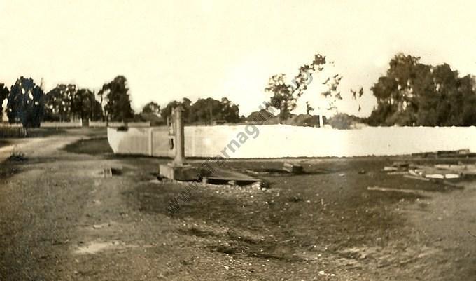
Tarnagulla Weighbridge, c1925
This is probably the only photograph in existence of the weighbridge in its original location at the corner of King Street and Sandy Creek Lane. It was erected in 1888 for the Borough Council by John Brideson to enable farmers to weigh their grain en-route to the flour mill, which has been demolished by the time of this photograph in the mid-1920s. The weighbridge itself was moved in 1927 to a site in Gladstone Street closer to the railway station.
The Methodist Church and Sunday School are well-illustrated in the photo, as is the bell between the trees. The obelisk of the War Memorial stands out above the picket fence, and behind that again is the big mullock heap of the once-mighty Poverty Mine. To the left of this mullock heap can be seen the remains of the mine's engine beds.
This is a very interesting photograph despite the lack of clarity.